
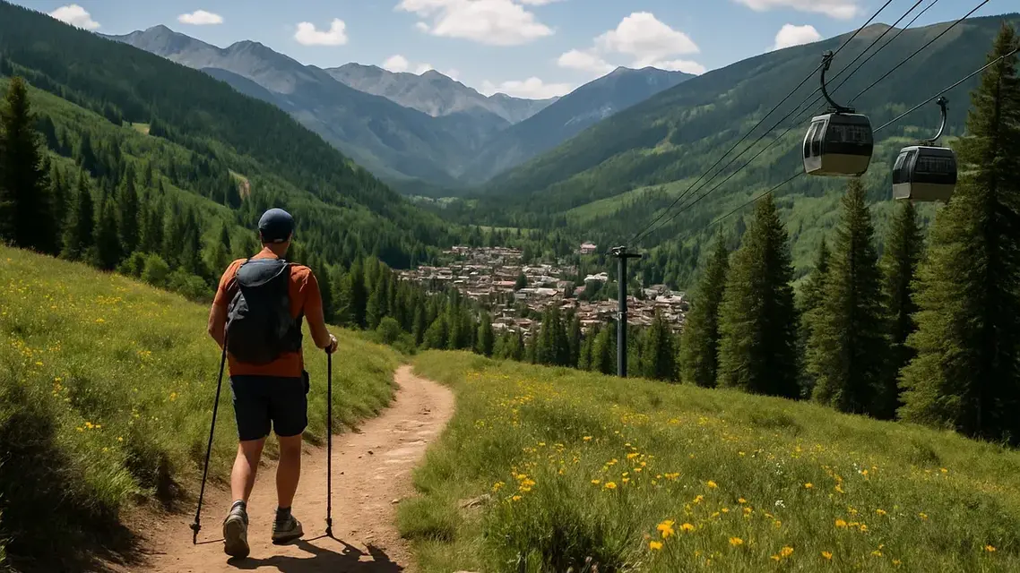
The best hikes in Vail are Booth Falls and Booth Lake, Pitkin Lake, Deluge Lake, Bighorn Creek and the Gore Creek Trail, which all start in East Vail and climb to high lakes and waterfalls, plus Shrine Ridge off Vail Pass, the easiest way to big views at 2.2 miles one way. Most East Vail trailheads have little or no parking, so the free East Vail bus is part of the plan.
Booth Falls, the most popular, has no trailhead parking in the summer hiking season: cars left at the trailhead or anywhere in the surrounding neighborhood, park or school are towed, so hikers ride the bus and walk the last quarter mile. It is also a long, steep climb rather than a casual waterfall stroll. The shortlist below picks a hike for each kind of day, and the full table further down puts nine trails side by side, so you can match a hike to your legs and your altitude before you set out.
What are the best hikes in Vail?
The best hikes in Vail, in order, are Booth Falls and Booth Lake, Pitkin Lake, Shrine Ridge, Deluge Lake, Bighorn Creek, the Gore Creek Trail, the Berry Picker and the paved Gore Valley Trail. Six start in East Vail and climb into the Eagles Nest Wilderness; Shrine Ridge, off Vail Pass, is the easiest route to big views.
The ranking is an editorial judgment that weighs each hike's payoff (a waterfall, a lake, a view) against its distance, climb and how easy the trailhead is to reach; it does not come from user ratings. Round-trip distances double Discover Vail's one-way figures, and the climb is the difference between the start and top elevations it lists, so treat it as a minimum.
| Rank and hike | Why go | Round trip | Climb | Difficulty | Trailhead |
|---|---|---|---|---|---|
| 1. Booth Falls and Booth Lake | A 60-foot waterfall, then an alpine lake | 9 miles | 3,080 ft | Advanced | Booth Falls Road, East Vail; no parking, take the bus |
| 2. Pitkin Lake | Two waterfalls and a lake under a wall of gray granite | 9.6 miles | 2,900 ft | Advanced | Fall Line Drive, East Vail; 15 parking spaces |
| 3. Shrine Ridge | Meadows and Mount of the Holy Cross views for the least effort | 4.4 miles | 747 ft | Intermediate | Shrine Pass Road, off I-70 exit 190 |
| 4. Deluge Lake | The only expert-rated hike here, very steep for the first 3 miles | 8.6 miles | 3,036 ft | Expert | Gore Creek Trailhead, Bighorn Road, East Vail |
| 5. Bighorn Creek | Beaver ponds and Bighorn Falls on a shorter day | 6.8 miles | 1,180 ft | Advanced | Bighorn Road or Columbine Drive, East Vail |
| 6. Gore Creek Trail | A full day along Gore Creek to Gore Lake | 12 miles to Gore Lake | 2,679 ft to Red Buffalo Pass | Advanced | Gore Creek Trailhead, Bighorn Road, East Vail |
| 7. Berry Picker | A big climb straight out of Lionshead, no car needed | 6.2 miles | 2,180 ft | Advanced | Base of the Eagle Bahn Gondola, Lionshead |
| 8. Gore Valley Trail | The easy option: a paved path beside Gore Creek | Any length | Little | Easy | Vail Village, Lionshead or East Vail |
For every East Vail trailhead on this list, Discover Vail recommends the free East Vail bus from the Vail Transportation Center over driving. Pitkin Lake is a quarter mile up Fall Line Drive from the Falls at Vail stop, and the Gore Creek, Deluge Lake and Bighorn Creek trails start about a third of a mile up Bighorn Road from the Main Gore/Bighorn stop.
How do you hike Booth Falls without trailhead parking?
Take the bus. Booth Falls trailhead parking is closed for the summer hiking season, and cars left in the surrounding neighborhood, park or school are towed. Park in the Vail Village or Lionshead structure, ride the free East Vail bus from the Vail Transportation Center to the Booth Falls stop, then walk a quarter mile up Booth Falls Road.
The Booth Lake Trail is 4.5 miles one way and rated advanced, climbing from 8,400 to 11,480 feet. It rises steeply through aspen for the first mile, then more gradually alongside Booth Creek, and passes the 60-foot Booth Falls on the way to the lake. The last quarter mile to the lake is steep and rocky. The trail enters the Eagles Nest Wilderness, and dogs must be on a leash. Early in the season, through June 6, hikers are asked to choose other trails because of wildlife sensitivity, and snow patches can linger in the conifer forest.
Getting there. Leave the car in the Vail Village or Lionshead parking structure and take the free East Vail bus from the Vail Transportation Center to the Booth Falls stop. The trailhead is a quarter mile up Booth Falls Road, and the Town of Vail's East Vail buses start running at 6 a.m. Private drop-off and pick-up at the trailhead is allowed on a limited basis. The town structures charge for parking in summer 2026, after a free first hour. The Booth Lake Trail listing has the trailhead details.
What are the East Vail lake hikes like?
The East Vail lake hikes are long, steep climbs of roughly 2,900 to 3,100 feet into the Eagles Nest Wilderness, each with limited or no trailhead parking. Pitkin Lake has two waterfalls, Deluge Lake is the steepest, Bighorn Creek is the shortest outing and the Gore Creek Trail is a full day to Gore Lake.
Pitkin Lake
The Pitkin Trail starts on the north frontage road at East Vail (I-70 exit 180) and climbs steeply for its first mile before easing through aspen groves, spruce-fir forest and a series of glacial moraines. After about 2.5 miles, switchbacks bring the first of two waterfalls on Pitkin Creek into view, and after several false summits the trail ends at Pitkin Lake, beneath an arc of gray granite. It is 4.8 miles one way. The White River National Forest advises parking in town and taking the free bus, since trailhead parking is limited.
Deluge Lake
The only expert-rated trail here spends about 3 miles crossing a steep, sunny, south-facing hillside before turning north into the Deluge Creek valley, where views open to the Sawatch Range and Mount of the Holy Cross. It is 4.3 miles one way to the lake at 11,746 feet. Start early: the exposed first stretch gets hot, and afternoon storms are common.
Bighorn Creek
Bighorn Creek climbs steeply for its first half mile, then more gradually through aspen and pine, past beaver ponds, the remains of old mining camps and Bighorn Falls. Views of Vail and the Bighorn drainage open near mile 2, and open meadows follow around mile 3. It is 3.4 miles one way, the shortest of the East Vail wilderness hikes.
Gore Creek Trail
The Gore Creek Trail follows Gore Creek for its first 4 miles, with some short steep sections, through meadows and aspen that give way to conifers. At mile 4 it forks: the left branch reaches Gore Lake at 6 miles, and crossing the creek leads over Red Buffalo Pass toward Summit County, 7 miles from the trailhead. Deluge Lake, Gore Creek and Bighorn Creek all start about a third of a mile up Bighorn Road from the Main Gore/Bighorn bus stop.
How do Vail's hiking trails compare?
Most Vail hikes are long climbs. Of the nine trails compared below, only Shrine Ridge, Upper Piney River Falls and the North Trail are rated intermediate; the rest are advanced, and Deluge Lake is expert. One-way distances run from 2.2 to 7 miles, and the lake hikes top out between roughly 11,400 and 11,750 feet.
Distances, difficulty ratings and elevations follow Discover Vail's trail pages. Distances are one way unless noted.
| Trail | One-way distance | Difficulty | Elevation | What to know |
|---|---|---|---|---|
| Booth Lake (passes Booth Falls) | 4.5 miles | Advanced | 8,400 to 11,480 ft | No trailhead parking; take the bus |
| Shrine Ridge | 2.2 miles | Intermediate | 11,000 to 11,747 ft | Meadows and views of Mount of the Holy Cross; drive to trailhead |
| Upper Piney River Falls | 3 miles (6 out and back) | Intermediate | – | Waterfall about 3 miles in; long dirt road to the start |
| Berry Picker | 3.1 miles | Advanced | 8,120 to 10,300 ft | Starts at the base of the Lionshead gondola |
| Bighorn Creek | 3.4 miles | Advanced | 9,608 to 10,788 ft | Steep first half mile; beaver ponds, old mining-camp remains, Bighorn Falls |
| North Trail (Buffehr Creek to Red Sandstone) | 3.7 miles | Intermediate | 8,127 to 8,254 ft | Closed April 15 to June 20 |
| Pitkin Creek | 4.8 miles | Advanced | 8,500 to 11,400 ft | Two waterfalls; ends at Pitkin Lake |
| Deluge Lake | 4.3 miles | Expert | 8,710 to 11,746 ft | Very steep first 3 miles |
| Gore Creek Trail (to Gore Lake or Red Buffalo Pass) | 6 miles to Gore Lake; 7 to Red Buffalo Pass | Advanced | 8,711 to 11,390 ft | Full-day trail; first 4 miles climb beside Gore Creek |
Which Vail hikes need a car?
Two of Vail's best-known hikes need a car. Shrine Ridge starts 2.4 miles up the unpaved Shrine Pass road from I-70 exit 190 at Vail Pass, and Upper Piney River Falls starts about 12 miles up unpaved Red Sandstone Road. Every East Vail trail, the North Trail and the Berry Picker can be reached on foot or by free town bus.
Shrine Ridge. Take I-70 exit 190 for Vail Pass, turn right onto the Shrine Pass dirt road (Forest Service Road 709) and continue 2.4 miles, just past Shrine Pass. The trailhead is on the left and parking is limited. The trail starts at 11,000 feet, so weather changes fast and layers matter. The meadows are the draw, along with views of Mount of the Holy Cross.
Upper Piney River Falls. The trail starts near Piney River Ranch, roughly 12 miles from Vail on Red Sandstone Road, an unpaved Forest Service road. Four-wheel drive is not necessary, but allow about 45 minutes from the start of the road. The ranch is open roughly June 21 through the last weekend of September, 9 a.m. to 6 p.m., with canoe and paddleboard rentals on the lake.
What are the easiest walks in Vail?
The easiest walks in Vail are flat: the paved Gore Valley Trail beside Gore Creek, the creekside path through Vail Village and Lionshead, which is wide enough for strollers, and the walk through Ford Park to the free Betty Ford Alpine Gardens. Eagle's Loop, a 1-mile trail at the top of the mountain, needs a summer gondola ticket.
- Gore Valley Trail and the Gore Creek path. The Gore Valley Trail is a paved, mixed-use path along Gore Creek from the villages toward East Vail. Through Vail Village and Lionshead, the Gore Creek Trail is improved gravel with paved sections wide enough for strollers.
- Betty Ford Alpine Gardens. A flat creekside walk from Ford Park. The gardens are open daily from dawn to dusk, with free admission and a suggested $20 donation. The Gore Creek path continues east to the Vail Nature Center, which is closed for the summer 2026 season during site improvements.
- Eagle's Loop. A 1-mile trail at the top of Vail Mountain that ends at Mid-Vail. It starts from the Eagle Bahn Gondola, which needs a paid ticket in summer, and Gondola One runs from Mid-Vail back down to the village. The gondolas do not run between the summer and ski seasons; the 2026 summer season's last day is September 27.
- Berry Picker. Not easy: it starts at the base of the Lionshead gondola and climbs the east side of the Bwana ski run before entering the woods. See the Berry Picker guide and the trail listing.
What rules apply on Vail hiking trails?
Most of Vail's high trails enter the Eagles Nest Wilderness, where dogs must be on a physical leash shorter than six feet, groups are limited to 15 people, overnight campers must self-register and fires are banned near lakes, streams and trails and above 11,000 feet. Some trails also close seasonally to protect wildlife.
- Dogs. On every trail that enters the Eagles Nest Wilderness, and on the North Trail, dogs must be on a physical leash; in the wilderness it must be shorter than six feet. See dog-friendly activities in Vail.
- Wildlife. Some trails close seasonally for wildlife; the North Trail is closed April 15 to June 20. Colorado Parks and Wildlife warns that moose defend calves and territory, and a moose that reacts to you means you are too close. See where to see moose in Vail.
- Wilderness rules. In the Eagles Nest Wilderness, groups are limited to 15 people, anyone camping overnight needs a valid self-registration form, and fires are banned within a quarter mile of any lake, within 100 feet of streams and trails, and above 11,000 feet.
- Weather and altitude. Afternoon thunderstorms are common in summer, and many trails climb above 10,000 feet. Bring a rain jacket, sturdy shoes, sunscreen, water, food, a first-aid kit, a map and a headlamp.
- Maps. Vail's welcome centers hand out trail maps. There are more than 100 miles of hiking trails in the area.
When is hiking season in Vail?
Discover Vail lists hiking in Vail as a May to November activity, but the high lakes, about 3,000 feet above town, have a shorter season. Hikers are asked to avoid the Booth Lake Trail through June 6, the North Trail closes from April 15 to June 20, and from October snow and ice return to the upper trails.
Discover Vail lists hiking as a May to November activity, but the high lakes keep a shorter season than the valley floor. NOAA's 1991–2020 normals for the town, at about 8,300 feet, show 4.8 inches of snow in May, under an inch in June and September, 8.6 inches in October and 25.9 in November. Booth, Pitkin and Deluge lakes sit roughly 3,000 feet higher. Early in the season, hikers on the Booth Lake Trail can meet snow patches in the conifer forest and are asked to choose other trails through June 6 because of wildlife sensitivity, and the North Trail is closed from April 15 to June 20. From October, expect snow or ice on the upper trails and plan on lower routes such as the Gore Valley Trail, or turn around below the lakes.
Fall is also big-game hunting season on the national forest around Vail. Colorado's 2026 deer and elk rifle seasons run October 14 to 18, October 24 to November 1, November 7 to 15 and November 18 to 22, and Colorado Parks and Wildlife advises non-hunters to wear fluorescent orange or pink. Fall color timing changes each year; see when the leaves change in Vail. In winter, many of these routes become snowshoe or ski terrain, covered in the snowshoe guide.