
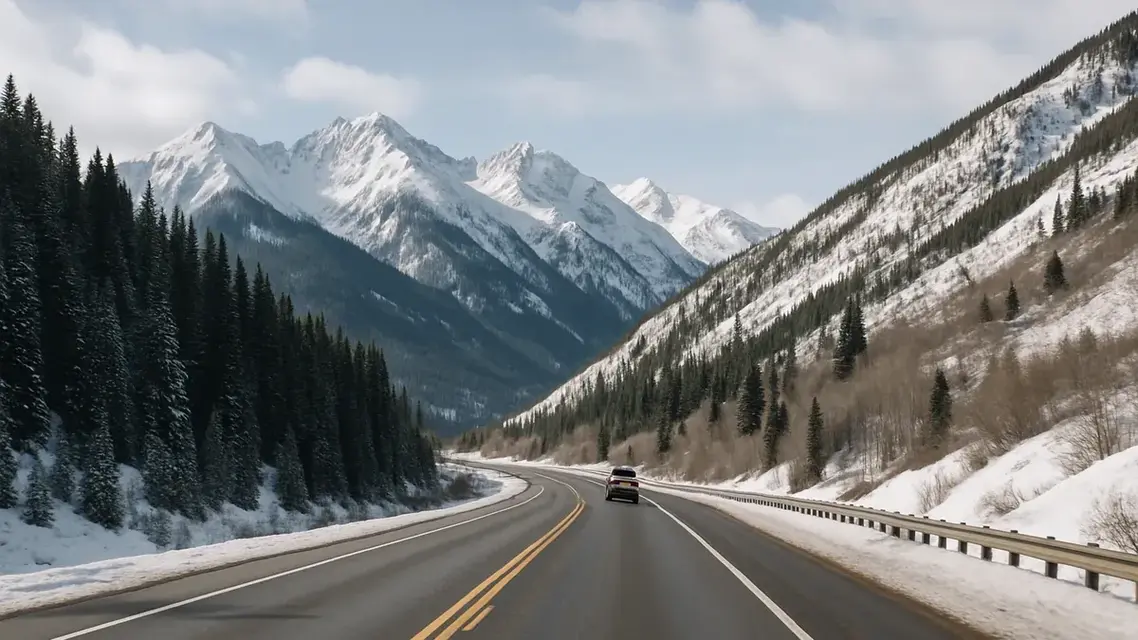
The way from Aspen to Vail is Highway 82 down the Roaring Fork Valley to Glenwood Springs, then east on I-70 through Glenwood Canyon. Aspen to Glenwood Springs takes about an hour, the same by car or by RFTA's bus rapid transit, and Glenwood Springs to Vail is a 50-minute drive, so plan on roughly two hours before stops, longer in winter weather. Without a car, the trip is two buses that meet in Glenwood Springs: RFTA to Glenwood, then Bustang to Vail. There is no passenger train between Aspen and Vail, and Independence Pass is not a shortcut to Vail.
For mileage, the two road routes compared and Independence Pass opening and closing dates by year, see how far Vail is from Aspen.
What are the ways to get from Aspen to Vail?
Driving is the main way: Highway 82 to Glenwood Springs, then I-70 east, roughly two hours. Without a car, take RFTA's VelociRFTA bus to Glenwood Springs and Bustang's West Line on to Vail. Private cars and taxis also make the trip. There is no train and no scheduled flight, and Independence Pass leads away from Vail.
| Option | How it works | Timing and cost |
|---|---|---|
| Drive | Highway 82 to Glenwood Springs (I-70 exit 116), then I-70 east to Vail (exit 176). | About an hour to Glenwood plus a 50-minute drive on to Vail. Year-round; canyon closures and storms change it. |
| RFTA bus, then Bustang | VelociRFTA BRT from Aspen to Glenwood Springs, then Bustang's West Line from the West Glenwood Park-n-Ride to the Vail Transportation Center. | BRT is about an hour. RFTA fares are by zone; Bustang tickets and the West Line timetable are on its route page. |
| Private car, limo or taxi | Registered operators are listed by Eagle County Regional Airport. | Prices come from the operator; ask for a written quote. |
| Independence Pass | CO 82 east of Aspen to Twin Lakes, seasonal. | Goes away from Vail; see below. |
| Train | No passenger rail serves Aspen or Vail. | Amtrak's nearest stop is Glenwood Springs; see below. |
| Fly | Aspen and Eagle County are separate airports. | No scheduled Aspen route appears on Eagle County's airline list. |
How do you drive from Aspen to Vail?
Follow Highway 82 down the Roaring Fork Valley to Glenwood Springs, then take I-70 east through Glenwood Canyon to Vail's exit 176. Aspen to Glenwood Springs takes about an hour and Glenwood Springs to Vail is a 50-minute drive. From September 1 to May 31, CDOT can put the Traction Law in force on both highways.
From Aspen, follow Highway 82 down the valley to Glenwood Springs, where I-70 begins its climb east through Glenwood Canyon toward Vail. By I-70 exit numbers, the main Glenwood Springs exit is 116 and Vail's main exit is 176, so the interstate portion is roughly 60 miles, with Eagle at exit 147 along the way. Glenwood Canyon is where a crash or a storm can shut the road. If a closure is expected to last more than an hour, CDOT recommends a northern alternate route on CO 9, US 40 and CO 13 and asks drivers to avoid highways south of I-70. COtrip shows current conditions.
From September 1 through May 31, CDOT can activate Colorado's Traction Law on I-70 between Dotsero and Morrison when storms or conditions call for it, and it can activate traction or chain laws on any state highway, Highway 82 included. Under the rules updated in fall 2025, compliance depends on the tires rather than the drivetrain: winter, all-weather or mud-and-snow tires with at least 3/16-inch tread, or chains or an approved traction device. The chain law is the last step before a highway closes. The CDOT traction law page has the current rules.
Can you take Independence Pass from Aspen to Vail?
Only as a long scenic detour. Independence Pass, Highway 82 east of Aspen, crosses the Continental Divide at 12,095 feet and leads to Twin Lakes and Leadville, well south of Vail. It reopened on May 21, 2026, and as of September 26, 2026, CDOT had not announced its fall closing; it typically closes on or near November 7.
Independence Pass, Colorado Highway 82 east of Aspen, crosses the Continental Divide at 12,095 feet. The summit is 19 miles east of Aspen and 18 miles west of Twin Lakes. It is the highest paved state highway in Colorado, narrow and curving, with steep drop-offs and stretches wide enough for one vehicle, and vehicles 35 feet or longer are prohibited.
Two points matter for a Vail trip. The road leads to Twin Lakes on the far side of the divide, not toward Vail; getting to Vail from there means continuing to Leadville, which is an hour's drive from Vail on a scenic byway. And the pass closes each winter. CDOT closed it on November 17, 2025 for the 2025-26 season and reopened it on May 21, 2026. In recent years it has closed between late October and mid-November and reopened the week before Memorial Day weekend. While it is closed, the road between Aspen and the I-70 corridor is Highway 82 through Glenwood Springs.
Is there a bus from Aspen to Vail?
Not a single bus, but two that connect in Glenwood Springs. RFTA's VelociRFTA runs from Aspen to Glenwood Springs in about an hour, and Bustang's West Line runs from the West Glenwood Park-n-Ride to the Vail Transportation Center in about an hour and a quarter on its September 2026 timetable.
RFTA's VelociRFTA runs between Aspen and Glenwood Springs in about an hour, with buses every 12 minutes or less at peak commuter times. Fares depend on the zones crossed: free within a zone, $2 to the next zone and $1 for each additional zone, in exact cash or by mobile ticket. From Glenwood Springs, Bustang's West Line, the state-run I-70 service between Denver and Grand Junction, stops at the West Glenwood Park-n-Ride on Wulfsohn Road and at the Vail Transportation Center at 241 South Frontage Road East. RFTA counts Bustang among its connecting services; use the RFTA trip planner to work out how to reach the West Glenwood stop, and the Bustang West Line page for the eastbound timetable. On the timetable posted in September 2026, the ride from West Glenwood to the Vail Transportation Center takes about an hour and a quarter.
Is there a train from Aspen to Vail?
No. Neither Aspen nor Vail has a passenger rail station. Amtrak's California Zephyr runs daily across Colorado with stops at Denver, Fraser-Winter Park, Granby, Glenwood Springs and Grand Junction. If you want part of the trip by train, Glenwood Springs is the connection point: RFTA's bus reaches Aspen in about an hour, and Bustang's West Line continues east to Vail.
Can you fly between Aspen and Vail?
Not on a scheduled flight. Aspen/Pitkin County Airport sits about three miles from downtown Aspen, and Eagle County Regional Airport, in Gypsum, is the airport for Vail; its published airline list has no Aspen route. Between the two towns, plan on the road trip described above.
Can you book a private transfer from Aspen to Vail?
Yes. Door-to-door transfers between Aspen and Vail are run by registered limo and taxi companies, which Eagle County Regional Airport lists on its ground transportation page. Prices come from each operator, so ask for a written quote before you book, and allow roughly two hours for the drive.
Epic Mountain Express runs shuttles and private SUVs between Denver International and Eagle County airports and the Vail, Beaver Creek, Breckenridge and Keystone areas. For a door-to-door Aspen to Vail transfer, contact a registered limo or taxi company; Eagle County Regional Airport's ground transportation page lists them. The airport is in Gypsum, a 40-minute drive or shuttle ride from Vail, and the closest airport to Vail covers flying in.
Can you stop at Hanging Lake between Aspen and Vail?
Yes, with a reservation. Hanging Lake's trailhead is off I-70 exit 125 in Glenwood Canyon, on the way east to Vail. Every visitor needs a time-specific permit, $12 a person from April 30 to October 31, and the 1.2-mile trail climbs 1,200 feet; the average round trip takes about three hours.
Hanging Lake is on the way, and heading east from Glenwood Springs you can reach its trailhead directly from exit 125. Leaving is the awkward part: to continue east you first drive west to the Glenwood Springs exit and turn back, an extra eight miles in each direction. A time-specific reservation is required for each visitor, at $12 a person from April 30 to October 31 and $10 from November 1 to March 31, with a three-hour hiking window and trailhead parking included. Arrive within 30 minutes of your slot in your own vehicle, since rideshare drop-offs, taxis and shuttles are not allowed, and leave pets at home. The trail climbs 1,200 feet in 1.2 miles, and the average round trip takes about three hours. Reservations are made at visitglenwood.com.
If you are choosing between the two towns, which is more expensive, Vail or Aspen compares costs. For mileage, summer and winter drive times and Independence Pass dates, read how far Vail is from Aspen, and browse the Vail hotels directory for a base.