
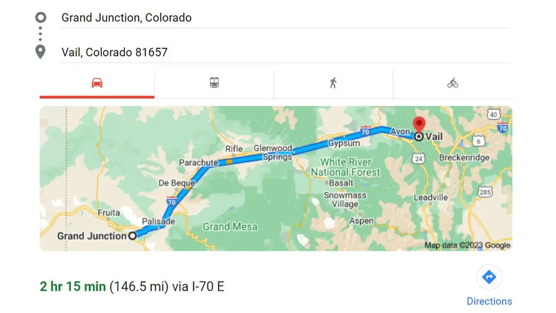
Vail to Grand Junction is about 145 miles west on Interstate 70, from Vail's exit 176 to the Horizon Drive exit (31). The Town of Vail puts Vail a 50-minute drive from Glenwood Springs, which is the first 60 miles or so. The rest is the Colorado River corridor through Rifle and Palisade, and the one place the drive can stop is Glenwood Canyon, where a crash or a storm can close the interstate.
The route in legs
I-70 exit numbers are mile markers, so subtracting one from another gives the distance between them. COtrip.org shows current road conditions.
| Leg | I-70 exits | Approximate miles |
|---|---|---|
| Vail to Eagle | 176 to 147 | 29 |
| Eagle to Glenwood Springs (main exit, through Glenwood Canyon) | 147 to 116 | 31 |
| Glenwood Springs to Rifle | 116 to 90 | 26 |
| Rifle to Palisade | 90 to 42 | 48 |
| Palisade to Grand Junction (Horizon Drive) | 42 to 31 | 11 |
| Total, Vail to Horizon Drive | 176 to 31 | about 145 |
The Town of Frisco measures 26 miles to Vail and 170 miles to Grand Junction, which leaves about 144 between the two. Other Grand Junction exits add or subtract a few miles.
Glenwood Canyon, closures and the traction law
Glenwood Canyon is the stretch that can close. CDOT's rest areas there are No Name (exit 119), Grizzly Creek (exit 121), Hanging Lake (exit 125) and Bair Ranch (exit 129). The Hanging Lake rest area is open only to drivers with a Hanging Lake permit, so it is not a general pull-off. If the canyon is expected to stay closed for more than an hour, CDOT recommends a northern alternate route on CO 9, US 40 and CO 13, and asks drivers to avoid highways south of I-70 and county and Forest Service roads such as Cottonwood Pass Road. Summer construction can also bring reduced speeds and lane closures. Check COtrip before you leave and again at Glenwood Springs.
In winter, Colorado's Traction Law is in effect on I-70 between Dotsero and Morrison from September 1 through May 31, which covers the Vail end of this drive, and CDOT can impose traction or chain laws on any state highway. Under the traction law, all-wheel-drive and four-wheel-drive vehicles need mud-and-snow, winter or all-weather rated tires with at least 3/16-inch tread, or chains or an approved traction device. The fine is $100 plus a $33 surcharge, or $500 plus a $157 surcharge if the violation closes a travel lane. Details are on CDOT's traction and chain law page.
Stops in driving order
- Glenwood Canyon path. The canyon has a recreation path for walking and biking, and the rest areas above are the places to stop.
- Hanging Lake. Driving west from Vail you cannot use exit 125. Take exit 116, the main Glenwood Springs exit, and return east to the trailhead, an extra eight miles each way. A time-specific reservation is required for every visitor, $12 from April 30 to October 31 and $10 from November 1 to March 31, with a three-hour hiking window and parking included. Arrive within 30 minutes of your slot in your own vehicle, since taxis, ride drop-offs and shuttles are not allowed. Pets are not permitted. The trail climbs 1,200 feet in 1.2 miles, and the average round trip takes about three hours. Reservations are made at visitglenwood.com.
- Rifle Falls State Park. Colorado Parks and Wildlife describes 60-foot waterfalls with limestone caves beneath them. From I-70 take the Rifle exit (exit 90), go north on CO 13 for four miles, then turn onto CO 325 and drive 9.8 miles. The park reaches capacity most weekends and often turns visitors away, so an early start or a weekday helps.
- Palisade. Palisade is at exit 42, before you reach Grand Junction, and the Fruit and Wine Byway winds through its orchards, vineyards, farm markets and tasting rooms.
- Colorado National Monument. Rim Rock Drive is 23 miles of sheer red rock canyon walls and overlooks, minutes from downtown Grand Junction. Plan 45 minutes to an hour to drive it without stopping.
Getting there without driving
Bustang's West Line, the state's I-70 bus between Denver and Grand Junction, stops at the Vail Transportation Center, Avon Station, Eagle, West Glenwood Park-n-Ride, Rifle, Parachute, a temporary downtown Grand Junction stop and Grand Junction Regional Airport. Timetables and tickets are on the Bustang West Line page.
Amtrak's California Zephyr serves Glenwood Springs and Grand Junction but has no stop in Vail or Eagle, so a train trip means getting to Glenwood Springs first, by car or by Bustang. Stops and schedules are on the California Zephyr route page.
Related routes
Glenwood Springs is also the junction for the drive from Aspen, covered in Aspen to Vail. Flying in is covered in the closest airport to Vail, and how to get to Vail covers the other ways in.