
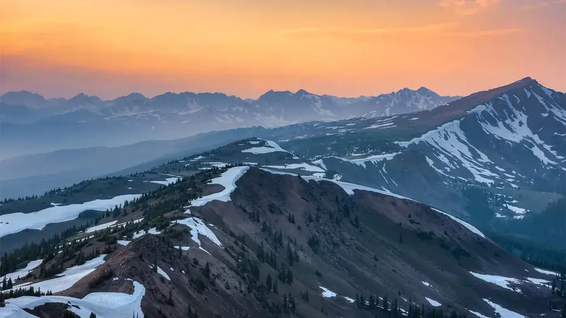
Vail is in the Gore Range, a stretch of the Colorado Rockies about 60 miles long that runs through Summit, Eagle, Grand and Routt counties. More precisely, the Vail area sits on the range's southwest flank. The high peaks of very old crystalline rock lie north and east of the Gore fault, and Vail is on the other side of that line, where the bedrock is layered sedimentary rock.
Where Vail sits on the range
USGS geologic mapping describes the Vail West area as lying on the southwest flank of the Gore Range, and the neighboring Vail East map straddles the Gore fault system, the range's western structural boundary. North and east of the fault, the high Gore Range is built of crystalline rock roughly 1.67 to 1.75 billion years old, mostly gneiss cut by granite. Southwest of it, the rock is younger and layered: the Pennsylvanian Minturn Formation, a mix of pink, maroon and gray conglomerate, sandstone, shale and limestone that dips gently south, and the mostly reddish sandstone and conglomerate of the Maroon Formation.
The Colorado Encyclopedia places the Gore Range in the northeast of Eagle County and the northern Sawatch Mountains in the southeast; Vail is on the Gore side. Vail Mountain, the ski area on that flank, has approximately 5,300 skiable acres according to Vail Resorts' annual report, including the seven Back Bowls and Blue Sky Basin. The skiable acres at Vail are covered separately.
Which way the Back Bowls face
The seven Back Bowls lie on the far side of Vail Mountain's main ridge from the village, out of sight of the Town of Vail, and in general they face south. Vail-Beaver Creek Magazine's guide to the bowls makes the same point about the light: with most bowls facing the sun head-on, there are few shadows to show the terrain, especially on cloudy days.
The aspect shapes the snow through the day. Vail's own trail notes describe Rasputin's Revenge, in Siberia Bowl, as directly south facing: dry powder in the morning can turn to heavy spring snow within a couple of hours. The runs Deuces Wild and Faro in Game Creek Bowl, just outside the seven, are south facing too. Sun Down Bowl is named for the sunset over it. Timing therefore matters as much as the last storm; how hard the Back Bowls are covers the terrain, and when the Back Bowls open covers the season.
The Gore Range at a glance
| Feature | Detail |
|---|---|
| Length | About 60 miles, touching Summit, Eagle, Grand and Routt counties |
| Highest summit | Mount Powell, a little over 13,500 feet |
| Protected core | Eagles Nest Wilderness, 133,496 acres, designated by Congress in 1976 |
| Trails | About 180 miles in the wilderness, reached from Silverthorne, Frisco and Vail |
| Rock of the high range | Early Proterozoic gneiss and granite, roughly 1.67 to 1.75 billion years old |
| Name | Sir St. George Gore, a 19th-century Irish hunter |
How the range came to be
The Gore fault has been active on and off since at least the early Paleozoic. USGS mapping shows it moving again in the late Paleozoic and during the Laramide deformation that built much of the Rockies, and the last faulting in the range is tied to the Neogene uplift of the Gore Range. On the eastern side, a major fault dropped the land down to form the Blue River valley. At least two glaciations sculpted the mountains bordering that valley, and the same two glacial episodes, the Bull Lake and the Pinedale, left deposits along the Gore Creek valley below Vail.
Hiking in the Eagles Nest Wilderness
Much of the high Gore Range lies inside the Eagles Nest Wilderness, managed by the White River National Forest, and its rules apply on the trails that climb from Vail:
- Overnight camping needs a free, self-issue registration form from the trailhead; day use does not need registration.
- Motorized equipment and mechanical transport are prohibited, which includes bicycles, and drones may not take off, land or be operated there.
- Camp at least 100 feet from trails, lakes and streams. Fires are prohibited within 100 feet of any stream or Forest Service trail, within a quarter mile of any lake, and above treeline.
Many of the high alpine lakes are heavily affected by increased visitor use, the Forest Service notes. The guide to hiking in Vail covers trails around town, and the stream that drains the Vail side of the range is the subject of what river runs through Vail.
From the range to the ski mountain
The Colorado Snowsports Museum tells the founding story this way: in March 1957 Earl Eaton, an Aspen ski patroller who had grown up in Eagle County, brought Pete Seibert to the top of what became Vail Mountain, a seven-hour trip breaking trail. The treeless bowls on the backside, only about 100 miles from Denver, convinced Seibert it was the place for a resort. Vail Mountain opened on December 15, 1962 at 9 a.m., with one gondola, two chairlifts and $5 lift tickets. The opening is covered in when Vail ski resort opened.
A name with a contested history
The Gore Range is named for Sir St. George Gore, who hunted across the American West in the 1850s. The Summit Daily reports that he claimed to have killed more than 2,000 buffalo, 1,600 elk and deer and 100 bears, that those figures are hard to substantiate, and that he is not believed ever to have set foot in these peaks; mapmakers later attached his name. In 2020 Summit County asked the state to consider renaming the range for the Ute people, using the word Nuchu, and the Vail Town Council split on the idea in 2021. The Forest Service's current Eagles Nest Wilderness page still calls the mountains the Gore Range. The story of the town's own name is in how Vail got its name.