
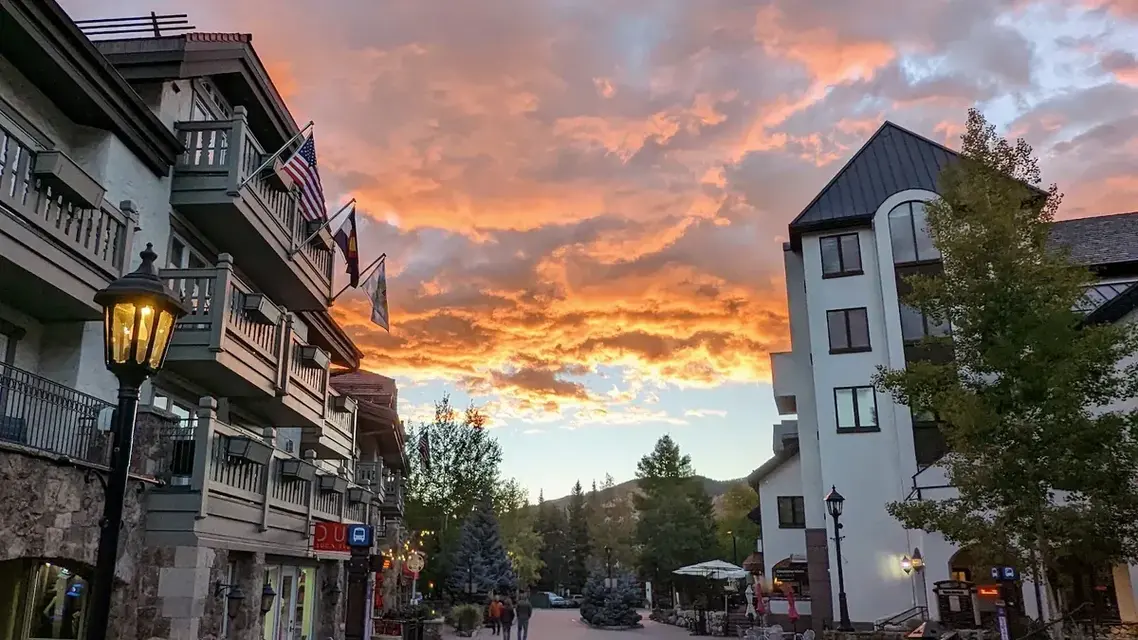
Vail is a town in Eagle County, in the central Rocky Mountains of Colorado, and it sits directly on Interstate 70: 97 miles west of downtown Denver and 119 miles from Denver International Airport, at an average elevation of 8,150 feet. Take exit 176 for Vail Village and Lionshead Village. The closest airport is Eagle County Regional (EGE) in Gypsum, about 35 to 38 miles west, and Aspen is about 100 miles away by road.
People often search for the "City of Vail", but Vail is an incorporated town, not a city. It stretches along the Gore Creek valley between the West Vail and East Vail exits, with Vail Pass rising to the east.
Vail at a glance
| Question | Answer |
|---|---|
| County | Eagle County |
| Type of municipality | Incorporated town (1966), home rule charter since 1972 |
| Average elevation | 8,150 feet |
| Highway and exits | I-70: exit 173 for West Vail, exit 176 for Vail Village and Lionshead Village, exit 180 for East Vail |
| From downtown Denver | 97 miles |
| From Denver International Airport | 119 miles, about a two-hour drive |
| Nearest commercial airport | Eagle County Regional Airport (EGE), Gypsum: about 35 to 38 miles, a 40- to 50-minute drive or shuttle ride |
| From Aspen | About 100 miles, roughly two hours via Glenwood Springs |
| From Breckenridge | About 35 miles, east over Vail Pass |
| Ski resort opened | 1962 |
| Residents | About 5,000 year-round and about 5,000 part-time |
Town, ski mountain and villages
The ski resort opened in 1962, the town was incorporated four years later, and since 1972 it has been a home rule town run by a manager and a seven-member council elected at large. The mountain that shares its name is a separate operation: Vail Resorts runs it on national forest land, and who owns Vail ski resort explains the arrangement.
Most visitors base themselves in one of two pedestrian villages. Vail Village and Lionshead Village are a 10-to-15-minute walk apart, and a complimentary in-town bus runs between them all day and into the evening. Lionshead is closed to cars and buses.
Where Vail sits in Eagle County
Eagle County was formed in 1883, and Interstate 70 enters it from Vail Pass on the east. Vail lies along Gore Creek. The county's geography takes in the Gore Range to the northeast and the northern Sawatch Mountains to the southeast, and what mountain range Vail is in explains which one the town belongs to. Minturn, Eagle-Vail and Avon are the neighbors down the valley, and about 350,000 acres of national forest surround the town. For the county itself, see what county Vail is in.
Before 1961 the meadows around Vail Pass held little more than ranches, a sawmill and wildflowers. Then Tenth Mountain Division veteran Pete Seibert and the other investors who became the founders of Vail Associates unveiled plans for a resort community, and a town grew up within months; the completion of Interstate 70 improved access further. The town, the road and the resort take their name from Charlie Vail, the engineer on the Vail Pass project, a story told in full in how Vail got its name.
Getting to Vail
By car
- From Denver, take I-70 west through the mountains to exit 176.
- From the west, Glenwood Springs is about a 50-minute drive. For the run from Grand Junction, see how far Vail is from Grand Junction.
- From Leadville, the scenic-byway route takes about an hour.
- I-70 is busiest on weekends. If you are heading east on a Saturday or Sunday, leaving the mountains after 7 p.m. keeps you out of the worst of the traffic.
- In winter, CDOT activates the Passenger Vehicle Traction Law when storms or conditions warrant, announced by highway signs and COtrip.org. All-wheel and four-wheel drive vehicles then need mud-and-snow, winter or all-weather tires with at least 3/16-inch tread; otherwise carry chains or an approved traction device. In a severe storm the chain law applies to every vehicle. Details are on CDOT's traction law page.
By air, bus and shuttle
- Eagle County Regional Airport (EGE), at I-70 exit 140 in Gypsum, is the closest airport to Vail. American flies there year-round from Dallas/Fort Worth and United from Denver, with more seasonal routes in winter. Denver International Airport has far more flights but a drive of about two hours. The closest airport to Vail compares them.
- Core Transit runs routes across Eagle County, and most are free, including a Vail/Beaver Creek Express Shuttle every 20 minutes in winter. Trips with stops in Gypsum, which includes the airport, or in Leadville carry a $3 fare.
- Epic Mountain Express sells shared and private airport shuttles to Vail from both Denver and Eagle County airports.
Step-by-step routes and timing are in how to get to Vail, Colorado. For the drives to the two resort towns people most often pair with Vail, see Vail to Aspen and Vail to Breckenridge. To place the ski mountain rather than the town, see where Vail ski resort is.