
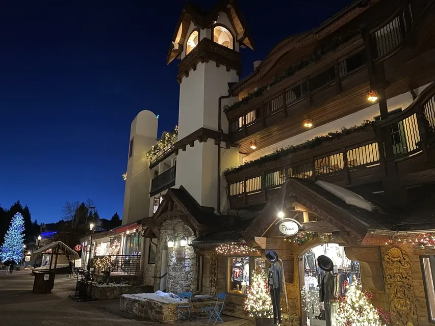
Photo above: Aron Hughes via Google
Vail is a long, narrow town that follows Gore Creek and I-70 along the valley floor, from East Vail to West Vail. Its center is two car-free villages, Vail Village and Lionshead, a 10 to 15 minute walk apart, with Golden Peak just east of Vail Village and Cascade Village a quarter mile west of Lionshead. Free Town of Vail buses link every part of it.
Read the map in that order, center out, and most planning questions answer themselves: which gondola is nearest, whether you need a car, and which bus reaches a trailhead or a grocery store.
How is Vail laid out?
Vail has three ski base areas on the south side of I-70: Vail Village with Gondola One, Lionshead with the Eagle Bahn Gondola, and Golden Peak with the Riva Bahn Express and the main ski school. Cascade Village adds a fourth lift, Chair 20. The Town of Vail divides the rest of the community into 12 neighborhoods, from East Vail to West Vail.
Three I-70 interchanges serve the town: exit 180 for East Vail, exit 176 for Vail Village and Lionshead, and exit 173 for West Vail. The town's neighborhoods are Vail Village, Lionshead Village, East Vail, Aspen Lane/Booth Creek, Booth Falls/Bald Mountain Road, Golf Course, Sandstone/Potato Patch, Buffehr Creek/Lionsridge/The Valley, Safeway/Vail Commons, West Vail north of I-70, Matterhorn/Glen Lyon and Vail Intermountain. Where Vail is in Colorado covers the wider geography.
What is in each part of Vail?
| Area | What is there | Getting there |
|---|---|---|
| Vail Village | Covered Bridge, Bridge Street, Gondola One, most hotels, shops and restaurants | Exit 176; Vail Village parking structure and Vail Transportation Center at 241 S. Frontage Rd. E. |
| Golden Peak | Main ski and ride school, terrain park, Riva Bahn Express | Short walk east of Vail Village; free in-town bus |
| Ford Park | Betty Ford Alpine Gardens, Gerald R. Ford Amphitheater, athletic fields | East of Vail Village; Ford Park lot at 720 S. Frontage Rd. E. |
| Lionshead | Eagle Bahn Gondola, Born Free Express, Arrabelle ice rink, shops and bars | Closed to cars and buses; Lionshead parking structure and transit center at 354 S. Frontage Rd. W. |
| Cascade Village | Chair 20, Grand Hyatt Vail, Gore Creek fishing | A quarter mile west of Lionshead |
| West Vail | Grocery and hardware stores, fast-casual restaurants, trail access | Exit 173; free West Vail bus routes |
| East Vail | East Vail Market, hiking and biking trailheads | Exit 180; free East Vail bus |
Vail Village
Vail Village is the pedestrian core: cross the Covered Bridge from the parking structure and walk up Bridge Street to Gondola One. The historic hotels are here, including The Lodge at Vail and Sonnenalp, along with the Colorado Snowsports Museum on the third level of the parking structure. Hotels in Vail Village compares where to stay.
Golden Peak and Ford Park
Golden Peak sits a short walk east of Vail Village and is home to the main ski and ride school and Vail's largest terrain park; Manor Vail Lodge is at its base. Just beyond, Ford Park holds Betty Ford Alpine Gardens and the Gerald R. Ford Amphitheater. Where Golden Peak is has the lift and parking detail.
Lionshead and Cascade Village
Lionshead is closed to cars and buses and centers on the Eagle Bahn Gondola (#19) and the square in front of The Arrabelle, with its winter ice rink. Cascade Village, a quarter mile west, is a resort area around Chair 20 and the Grand Hyatt Vail. Things to do in Lionshead fills in the rest.
West Vail and East Vail
West Vail, north of I-70 at exit 173, is the everyday shopping district, with the town's Safeway, hardware and fast-casual restaurants. East Vail lies east of the Vail Golf Course and is the gateway to trailheads such as Booth Lake, which has no trailhead parking, so ride the free East Vail bus. Hiking in Vail maps the trails.
How far apart are Vail Village and Lionshead?
Vail Village and Lionshead are about a 10 to 15 minute walk apart along Gore Creek, and the free in-town bus runs between them all day and well into the evening. On skis, the Born Free Express lift in Lionshead and a traverse from Cub's Way to Gitalong Road link the two bases, and green and blue runs connect them from above.
How does the free Vail bus work?
The Town of Vail runs free buses year-round, one of the largest free transit systems in the country. The in-town route shuttles between Vail Village and Lionshead, and outlying routes serve West Vail, East Vail, the Golf Course, Lions Ridge and Sandstone. The RideVail real-time bus map shows arrivals.
The 2026 summer schedule runs from June 8 until the winter schedule starts in mid-December; under it, the East Vail route runs from 6 a.m. to 2 a.m. and the West Vail Red route every 20 minutes. Outlying stops are by request, so pull the cord. Pets are not allowed except trained service animals, and bikes ride on front racks on outlying buses but not on in-town buses.
Where can you park in Vail?
Vail's main public garages are the Vail Village structure at 241 South Frontage Road East and the Lionshead structure at 354 South Frontage Road West, with the Red Sandstone Garage north of I-70 as overflow. The Town of Vail makes parking in its structures and lots free for fall from September 28, 2026, and its 2026/27 winter parking program begins November 20.
Ford Park and the Soccer Lot serve the east end of town but allow no overnight parking, and the Donovan lot at 1600 South Frontage Road West has free day parking, with no parking from 11 p.m. to 6 a.m. Where to park in Vail has rates by season.
Where can you find official Vail maps?
Official Vail maps come from three sources. Vail Mountain publishes trail maps for the Front Side, Back Bowls, Blue Sky Basin and ski school, plus summer hiking and biking maps; the Town of Vail posts its bus map; and Discover Vail, the town's marketing district, runs an interactive map with a printable version and staffs welcome centers in Vail Village and Lionshead.